Showing posts with label Snowshoeing. Show all posts

Tuesday, June 14, 2011

Howe Sound Crest Trail


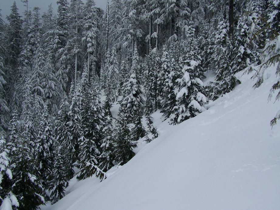
Still lots of snow but the trail is finally starting to thaw out.


Christmas Gully is freakin steep. Ya need cramp ons and an ice axe. I forgot mine. I thought the snow would be too soft.


I ended up sliding half way down the gully.


I'll bring them next time.

Saturday, May 21, 2011

Hemlock Valley


I didn't realize how close Hemlock is to Harrison. You can get a glimpse of Harrison from Hemlock just like you can get a glimpse of the Indian Arm from Seymour.


They're a little bit more Nazi on Hemlock about hiking around on "Controlled Recreational Areas." Every other local mountain has BC Parks trails you can hike on during the off season. I'm not sure why I would buy a home on Hemlock if I wasn't allowed to hike around. Kinda silly really.

Thursday, April 28, 2011

Ski to Sea


Fresh snow on the local mountains again this morning. Since the ski area is closed now I cut across the ski hill to the Howe Sound Crest trail. All the trail markers are under 10 feet of snow. Even the map shelter at the base is buried.


The way up was magnificent. Not much visibility at the top the the way up was worth it.


Then instead of waiting in rush hour I went over the White Cliff. Now that is what I'm talking about. The best things in life are still free.


Thursday, July 29, 2010

Mount Baker Revisited


Sunrise behind Mount Baker July 29 2010. Now that's what I'm talking about. Here are a few more:


Wednesday, March 10, 2010

New Snow on Cypress


Well Mother Nature certainly has a twisted sense of humour. Now that the Winter Olympics are over it snows on Cypress. What an ordeal.

I remember right before the Olympics started. They were trucking in snow from Manning and had this huge crane helicopter bringing that now to the freestyle moguls and Aeriel's part of the venue. Meanwhile they had a huge backhoe on Sky chair filling up a giant bucket that another regular helicopter was taking over to the other side of the venue.

As they were doing all this, the fresh snow line in the trees was just above the venue. Somewhat ironic. Just a little lower and none of that would have been needed. Last year we had 15 feet of snow during the same period. Then when it's all over it snows. Ya can't argue with Mother Nature. I still think everyone did a colossal job pulling it off despite the obstacles and as someone said, all the sunshine and warm weather was great for all the street parties downtown.


So now Cypress is open again and ready for business and the likes of us pions get some more extra work out of the season. Today I took my free pass and my six dollar skis with the mix and match home installed bindings and hit the slopes. It was nice. You could still feel there was a hard icy base under the new snow but the new snow was nice to work with.

Last time I hit a patch of slow snow and went down hard on my head in the packed ice. The good news was that I didn't break a leg and got my din settings right. The bad news is I had a road rash scab on my face for a couple of weeks. Such is life. It's all good in the end. Well not all but most of it and the conditions now are great.

Saturday, February 6, 2010

Snow Dunes on Seymour


Glad to see snow at higher elevations. This is a photo of First pump from second pump on Seymour. Right after first pump there are always cool snow dunes all over each winter. http://finiansworld.blogspot.com/2009/04/beautiful-day-on-seymour.html


Someone built a cool igloo on third pump so I put an Australian Boxing Kangaroo flag beside in in honour of the IOC.


First and second pump from third pump on Seymour with Boundary bay and the Gulf Islands in the distance.


Close up of first pump from third pump.


Indian Arm and back country from third pump which is Mount Seymour.

Wednesday, January 27, 2010

Hollyburn Ridge at Night


Instead of sitting in rush hour traffic after work today I borrowed a head lamp and hiked up Hollyburn ridge to watch the sun set. The first picture is of Vancouver with Boundary bay with the Gulf Islands and Vancouver Island in the background similar to the view from Brocton Point on Seymour but with downtown and Stanley Park in the foreground.


This is a shot of the Olympic venue on Cypress from Hollyburn ridge today showing there is some snow. This is a shot of the Lions on the left, back country and Grouse on the right from Hollyburn ridge:


There wasn't much of a sunset because it was cloudy but as I waited for it to get dark the city lights looked amazing. My camera can't take very good pictures at night. From Hollyburn ridge the city lights looked bigger and brighter than they did half way up or from the view point you can drive to. It was magnificent.
.
Climbing down in the dark with a headlamp was awesome. They have bamboo poles with reflective tape marking the trail. At night headlamps reflect on the tape and they glow in a line marking the trail.

Thursday, January 21, 2010

Brockton Point


There are two Brockton Points in Vancouver. One in Stanley Park with the lighthouse and the other on Mount Seymour above and beside the Mystery Peak Chair. This is the view from Brockton Point on Mount Seymour.

Ya kind of power past it on your way up to First, Second and third Pump on Mount Seymour. I had a late start today and I had to be back for a Vanoc meeting so I stopped here and had some hot chocolate.

If you click on the picture and look carefully you can see the Fraser River winding around Richmond to it's mouth. Just past that you can see the Tsawwassen Ferry Terminal. In the middle you can see Boundary Bay as well as Crescent Beach and Whiterock Beach in the centre.

On the far left you can make out the Blaine harbour as well as Birch Bay. Once again you can see the mountains on the Gulf Islands and Vancouver Island in the distance. Something I've always took for granted rushing past. Now it's a nice place to stop and enjoy.

Wednesday, September 23, 2009

Mount Baker up close and personal


Finally made it to the glacier on Baker yesterday. Back road to Heliotope ridge trail, climbers trail, up Hog's back, then up the glacier to the Roman Wall. Got lost coming off the glacier trying to get back to Hog's back. Ended up spending the night on the mountain and sleeping under the stars. That was interesting. The glacier was magnificent.


Here's some more pics: www.facebook.com/album.php?aid=144422&id=666809539

I met a Jedi camped at Hog's back. He was a professional guide that had just finished climbing the summit with a Canadian from Banff. He said it took them 9 hours from the base camp on Hog's back. I was surprised. It looks so close. Yet we were only at 6,000 feet and the summit is over 10,000.

I asked him about global warming and if he had noticed the glacier receding and he said totally. He said the glacier is so far receded it's wrecked and that glaciers don't regenerate until another ice age. Interesting. He also said the conditions are even more hazardous than normal and that there have been several climbers with a lot of experience who have died this year in the Cascades as a result of the unpredictability of the broken up glaciers.


I knew I wouldn't be able to make it to the summit but I just wanted to touch the glacier and see if I could climb around on it with crampons and an ice axe. Sure could. The axe was more in case I slipped. Climbing on the glacier in the warmth around noon was great.


Here's the video clip:
www.youtube.com/watch?v=TRVu4aN_58A

Sunday, April 26, 2009

Sunrise Hollyburn Ridge


Got some nice shots of the sunrise from Hollyburn Ridge today. I remember meeting a guy on Thunderbird Ridge a couple of winters ago. He had dug a bench in the snow and was quietly reading a book overlooking Fromme Mountain. It was a beautiful place to stop and appreciate the view.

We spoke for a bit and he said the view at sunrise was awesome there. I paused and asked how he got then in time for sunrise since this was on Grouse and the gondola doesn’t start running until 8:00 AM. There's a brave hike after the gondola ride to get there. He said he worked on the mountain so he would go early having slept on top of the mountain. I thought that was a really good idea. I thought about doing the grind in the dark and then hiking up Dam mountain and Thunderbird ridge to see the sunrise and thought naw… that’s an awfully long way especially in the dark.

My next best brainstorm was to try it on Hollyburn Ridge. I could climb up in the dark with my miner’s light they use for midnight snowshoe fondues. I was ready to go one day but the weather said rain so there would have been no visibility. Today was the perfect day. Forecast said yesterday would be cloudy but today would be sunny.

I was shooting for getting there an hour before sunrise but didn’t get there till half hour before sunrise. It was later than I had hoped so I didn’t need the lights. I made it to the first ridge on the base of the summit when the sun rose.


From the peak it was full blown and the rays of light were beaming down the mountains into the valley’s. It was awesome. The sunrise thing is kind of a process to experience. Just like a sunset in reverse. My father was big into photographing sunsets. I like sunrises. Makes me think of that song Boston by Augustana. It symbolizes new beginnings. I remember jogging on the beach every day for a while for the sunrise in Bray outside Dublin. That was awesome too.


I like the Lions from Hollyburn Ridge because you can get a peak of what’s behind the Lions.

Tuesday, April 7, 2009

Sunshine on Mount Baker

What a day.


This is a close up of Baker from the mountain.


This is a view of Baker from Abbottsford.


This is the visitor centre in the second level of Heather Meadows under snow. I guess it doesn’t open until latter in the spring. Table Mountain is just above the visitor centre.


It was mid week so the ski runs were closed and we could snowshoe right up the ski run. Being on Baker makes me think of the Swiss Alps. There are mountains all around you.


From there it’s backcountry.


This is the other side of Table Mountain and Baker. Click on the picture for a better view.


This is another close up of Baker. Gotta love it.